Secret Maps at the British Library is absolutely engrossing, 5 stars. 24 October – 18 January 2026. Of the 4 million maps in the collection, the Lead Curator of Antiquarian Maps, Tom Harper, has cherry-picked 100+ for our delectation, and as he doesn’t have enough of his own, he’s borrowed a choice few from other collections. It’s been a 5-year process.
Of the 4 million maps in the collection, the Lead Curator of Antiquarian Maps, Tom Harper, has cherry-picked 100+ for our delectation, and as he doesn’t have enough of his own, he’s borrowed a choice few from other collections. It’s been a 5-year process.
Maps are tools for demystifying the unknown, and the exhibition is organised by the scope of their importance, from the global to the national to the personal. From the Age of Empire, maps charting star systems to enable navigation, or coastlines with friendly trade hubs, possessed great power and worth. Catherine of Braganza’s wedding trousseau included a huge, illuminated volume mapping all the Portuguese harbours in the Indian Ocean. Kerching. More recent maps made during the two world wars give a feel for the desperate game of cat and mouse between rival powers as they attempted to infiltrate each other’s administrations. Maps were worth dying for.
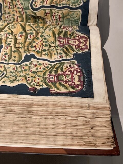
Portuguese harbours in the Indian Ocean
And lying for. The VOC, The Dutch East India Company secured an injunction against a map maker, preventing him from printing a globe showing that the southern tip of South America was navigable because it blew up their strangle-hold on the only alternative trade route. The map maker contested it, credit to him – the VOC must have exerted huge pressure and offered great rewards for keeping their secret. He won.
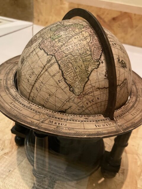
The VOC tries to deceive the world
Some maps are touching to see and give insights into the reality of war and how soldiers survived with thoughts of home. The trench systems around la Boisselle associated forever with mud-bath and blood-bath were given names such as Dunfermline Street and Dorset Street. A map of a PoW camp indicating to escapees where to turn left for Hanover, includes a soccer pitch. Bogus maps were used to fox the enemy, with coded place names like ‘Rugger’ and ‘Cricket’.
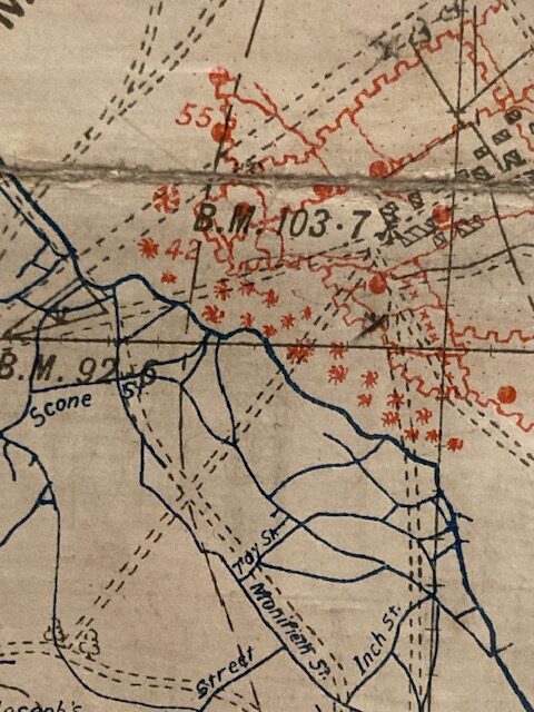
Trench systems, The Allies in blue, asterisks denote craters
Another map surprised me. I had assumed the Luftwaffe’s game was annihilation because of the dog’s dinner they made of our country during the Blitz. BUT… A Luftwaffe map shows very precise targets in London such as The Admiralty but not the Houses of Parliament, Tothill Street but not Buckingham Palace, so the intention was precision-bombing.
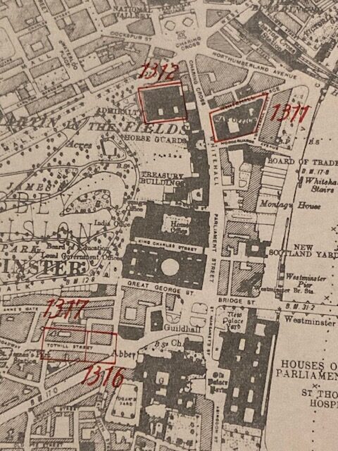
Luftwaffe targets in red
Current live-mapping of our locations by apps is also covered, with the associated safety and confidentiality issues. A map of the future calculating flooding after all the ice-caps have melted was sobering. Forget dinghies in the attic, it’s time to buy mountains. In New Zealand apparently.

Hi! I have a ‘portfolio’ lifestyle, jumping between mum, journalist, curator of my own museum, chauffeur, French tutor and carer. I love music, dance, theatre and dancing in the evenings, and helping others to enjoy life. I’ve been through the mill healthwise, along with my family, and am grateful for every day.
